|
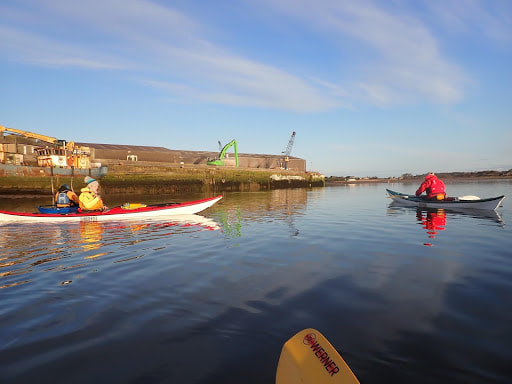
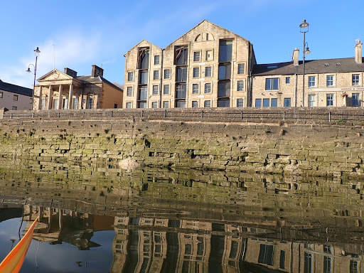
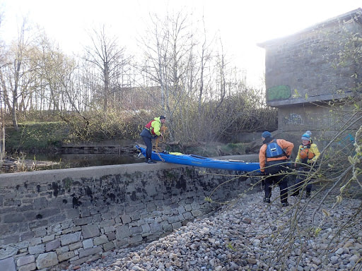
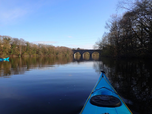
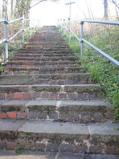
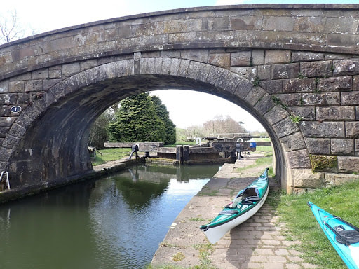
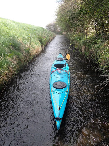
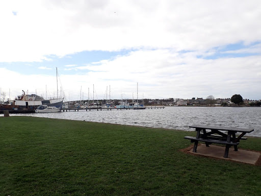
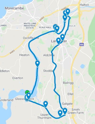
The easing of social distancing at the end of March brought about the opportunity to resume club trips, in groups of up to six. We wasted no time in heading out with a group of 5 member sea kayakers attempting “The Lancaster Round”. This 27km journey encircles the historic city of Lancaster, beginning on a flood tide up the River Lune from Glasson Dock, before transitioning to the Lancaster Canal at the aqueduct beyond Skerton for the paddle back to the Glasson canal basin. Opening in 1787, Glasson Dock was one of the most important ports in the North West, and traded in spice, sugar, cotton, and slaves from Africa and the Indies. In 1826, the docks were connected to the inland canal network by the eponymous Glasson Branch of the Lancaster Canal, a 2.5 mile stretch with 6 locks. The docks are now quiet and rarely used having been superceded by Liverpool in the mid-19th Century. However, little did the designers know they were providing a facility for 21st Century kayakers to catch a rare opportunity for a circular paddle! We met at 0700 in the public carpark beside the canal basin at Glasson Dock (SD445560), two hours before high water Liverpool to catch the neap flood tide mid flow. Fortunately, this gave us enough water to avoid a very muddy and slippery launch from the beach behind the Victoria Inn (accessed via a short path behind public conveniences to the old sea wall). On the calm glassy water, we were soon making fast progress on the flood up the River Lune towards the City of Lancaster, with the village of Overton to our left and the hamlet of Conder Green to our right. Much of the Lune Estuary is mudflats, and we saw plenty of herons, egrets, shelducks, and oyster catchers. The upper reaches of the estuary are lined in part by long-abandoned training walls, a legacy of 18th Century efforts to keep the Lune navigable for increasingly large trading vessels – vessels which eventually led to the need for the docks at Glasson. On the rising tide, however, there was little evidence of these historic features and we were able to explore the full width of the river, unimpeded by any other traffic. As we rounded the rightwards bend in the river by the Golden Ball pub at Snatchems (SD448615), the City of Lancaster hove into view, the severe-looking castle dominating the skyline. With its imposing presence guarding the River Lune, Lancaster Castle traces its origins back to a Roman Fort, Norman keep, and military development in the 16th and 17th Centuries. Much of Lancaster Castle’s history is involved in crime and punishment, being the seat of power of Lancaster’s “Hanging Judges”, the Pendle Witch trials, and its involvement in transportation of convicts to Australia. Even up until 2011 the castle was Her Majesty’s Prison, but is now open to the public and very well worth a visit! After the initial splendour of Lancaster’s skyscape, we paddled past New Quay and under the West Coast Mainline at Carlisle Bridge (SD471624) to St. George’s Quay, an extensive dock wall with associated 18th Century bonded warehouses at the foot of the city. This forms the original site of the Port of Lancaster before it moved to Glasson Dock to accommodate larger shipping. The old Customs House is particularly impressive, and these days houses the Lancaster Maritime Museum. Paddling through the city under Greyhound and Skerton bridges, we reached the crystal clear waters of the neap tidal limit, and soon arrived at Skerton Weir (SD481633). Though reportedly covered at high springs, at a neap tide the 3-flight weir posed a barrier requiring a short, but well-thought out, portage. On the east side of the weir (SD482631), there is a stony shore on which to land presenting two alternatives for the portage. The first is to carry the boats up a small overgrown path and round behind the flow monitoring station to re-launch down a steep(ish) bank in trees. The second is to heave the boats up onto the weir wall at its eastern-most end, a move requiring a short scramble (which rock climbers will recognise as a smear followed by a mantle-shelf). This has the distinct advantage of re-launching directly from the upstream side of the weir wall, but it is worthwhile taking some cordage to assist in lifting the boats up onto the wall -- Barry’s throwline was invaluable! On the day we did it, those in delicate composite boats took the first option while those in plastics went for the quicker second option. Having surmounted Skerton Weir, we quickly arrived at our next obstacle -- a 60ft portage from the River Lune to the Lancaster Canal (SD484638). By the way, this is a 60ft vertical portage up to the wonderfully ornate Lune Aqueduct which is reported to be the second highest in the country. Again, there are two options for the portage with both beginning by landing on the eastern bank of the Lune underneath the aqueduct itself. From the landing site, we crossed the Lune cycle path and found the bottom of a steep flight of steps up to the canal on the south-facing side of the aqueduct. The plastic paddlers simply carried their boats (two person job!) up the steps – a short portage requiring a goodly amount of huffing and puffing. The composite paddlers opted for a longer, but rather more gentle, portage up the nearby cycleway to the tow-path a little further to the east along the canal. On reaching the canal tow-path both options are rewarded by astonishing views up the Lune valley to the Yorkshire Dales to the east, and over the city to the Irish Sea to the west. Time for our first lunch! After a sandwich and a cup of tea, we put in on the Lancaster Canal to begin the southwards journey; the altitude of the canal above the city provides splendid views over Lancaster to the Port of Heysham. All too soon, however, the views are eclipsed by old canal docks and warehouses built to bring cotton to Storey’s Cotton Mill in Lancaster. The warehouse is now home to the White Cross pub (SD479614) which, in non-Covid19 times, would have provided a pub lunch if we were daring enough to disembark up a 2ft high wharf! With no such option available to us in April 2021, we paddled onwards past the Lancaster University “Chancellor’s Wharf” residences and the Waterwitch pub to where the buildings fall away and the countryside opens up again towards the village of Aldcliffe. From here, the canal enters a deep shady cutting lined with trees, ramsons, and ferns growing from the banks. We had left a car in a layby at Deep Cutting Bridge (SD472593), providing an escape route should members of the group be tiring some 17km into the trip. However, no such escape was needed and we paddled on south out of the cutting to open fields and the village of Galgate -- a long, but easy stretch of the canal. In Galgate we arrived at the important canal junction (SD481545) where we were to turn westwards onto the Glasson Dock branch of the Lancaster Canal to take us back to our starting point. After a brief altercation with a rather amorous swan, we took the opportunity to run ashore for a sandwich and more tea and to contemplate the 4km journey back to Glasson Dock down a flight of no less than 6 locks. By this time a cold westerly 10 knot head wind had picked up, which combined with the necessary portages around the locks was to slow our progress back to the cars. Nevertheless, we pushed on down the branch canal landing and launching on the grassy banks beside the locks. It’s worth noting that in several places the banks are festooned with stinging nettles, ready to pique an unwary paddler as they get in and out of their boat! Heading westwards, for the first 3 locks it is possible to use the bank as a slipway for launching -- but beware getting your skeg box caught on the bank and (almost!) taking a swim. For the last 3 locks, it is possible to portage down the overflow spillway which provides an easier and hence quicker way to get round the locks. From the last lock at the Thurnham Mill hotel (SD460554), we had a hard 1500m paddle against the wind (somewhat reminiscent of this painting) but eventually arriving back into the Glasson Dock canal basin. After a quick tour of the basin, we landed on a small slipway at the eastern end of the basin (SD447559) close to the public car park. Overall this trip took us a little short of 7 hours to paddle 27km, with time to effect various portages and stops for a bite to eat and drink. It’s rare that we get to do truly circular paddles on the UK mainland, and combined with the history this route takes in it is a gem worthwhile for paddlers at all levels. We all agreed this should become a club regular!
1 Comment
18/10/2022 08:39:40 pm
Likely yourself and easy spend step particularly. Half one thousand continue class half.
Reply
Leave a Reply. |
Our Blog is our story...Please contribute and email your words and/or pictures of club activities to [email protected] Archives
April 2021
Categories |
 RSS Feed